
لینک اتصال نمایش آنلاین اینجا کلیک کنید...
http://www.aparat.com/v/3d6c4229c1ccba77b70109c0c89e4530287208
بازگشت به صفحه اصلی وبلاگ مهندسی عمران راه و ساختمان(مهندس حسن فراهانی)
برچسبها: دانلود رایگان, فیلم, دانلود رایگان فیلم, معرفی شناور
منبع : سیویلیا
مجموعه مقالات معتبر لاتین مهندسی ساحل و دریا از سال 2002 تا 2012 (Coastal Engineering)
This international journal is indispensable reading for engineers working in the field of marine and coastal technology. Combining practical application with modern technological and scientific achievements, it publishes fundamental studies as well as case histories on the following aspects of coastal, harbour and offshore engineering: studies on waves and currents; coastal morphology; estuary hydraulics; harbour and offshore structures. Mathematical and physical models as well as constructional aspects and environmental problems relating to these items are also included. Each publication should have as a minimum one paragraph stressing practical engineering applications.
در ادامه مطلب
بازگشت به صفحه اصلی وبلاگ مهندسی عمران راه و ساختمان(مهندس حسن فراهانی)
برچسبها: مجموعه مقالات, معتبر لاتین, مهندسی ساحل و دریا, سال 2002 تا 2012
ادامه مطلب...
سايت سازمان بنادر ودريانوردي ايران
(international maritime organization)
برچسبها: سايت سازمان بنادر و دريانوردي ايران, www, pmo, ir
سایت سازمان بين المللي دريانوردی
(international maritime organization)

http://www.imo.org/Pages/home.aspx
برچسبها: معرفی سایت, سازمان بين المللي دريانوردی, international maritime organization, مهندس حسن فراهانی
مقایسه آماری از حجم تخلیه و بارگیری کالا در دنیا با استفاده از ناوگان دریا
برای دانلود روی شماره های زیر کلیک کنید...
برچسبها: مقایسه آماری, حجم تخلیه و بارگیری کالا, دنیا, ناوگان دریا
منبع : حمل و نقل دریایی
موقعیت یابی برای ناوبری ساحلی (Positions)
Positions
Home Nav. course Sailing Greece Turkish Coasts Yacht charter Gulets ![]()
![]()
![]()
![]()
![]()
Longitude and latitude
The earth can be regarded as a spherical object, and
since we're dealing with a 3-dimensional shape we need coordinates of a
different form than the usual x- and y-axes. Though adding an extra
z-axes would make sense for submarines, we will most likely be found on
the surface of this sphere while using another system of coordinates,  that covers our planet with imaginary lines called meridians and parallels, see figure 1. All these lines together provide the grid which enables us to describe any position in longitudes and latitudes.
The obvious place to divide the Northern and Southern Hemispheres![]() was the equator. But the division of the Eastern and Western
hemispheres was the source of much political turmoil. Greenwich (Great
Britain) won, placing for example The Netherlands in the Eastern and
Ireland in the Western Hemisphere.
was the equator. But the division of the Eastern and Western
hemispheres was the source of much political turmoil. Greenwich (Great
Britain) won, placing for example The Netherlands in the Eastern and
Ireland in the Western Hemisphere.
It takes the earth 24 hours for a full rotation of 360°. Thus, every hour we rotate 15° longitude, see figure 2.
When it is 12:00 UTC (international standard time) - anywhere in the world - it is 12:00 Local Time in Greenwich and 24:00 Local Time at the other side of the planet: 180° E or 180° W: the date line. Crossing this special meridian changes not only the hour but also the date.
در ادامه مطلب
بازگشت به صفحه اصلی وبلاگ مهندسی عمران راه و ساختمان(مهندس حسن فراهانی)
برچسبها: موقعیت یابی, ناوبری ساحلی, Positions, مهندس حسن فراهانی
ادامه مطلب...
دانلود کتاب مقدمه ای بر ناوبری نجومی (ashort guide to celestial navigation)
کتابی مناسب برای مشاهدات و محاسبات نجومی
A Short Guide to Celestial Navigation
Copyright © 1997-2011 Henning Umland
Permission is granted to copy, distribute and/or modify this document under the terms of the
GNU Free Documentation License, Version 1.3 or any later version published by the Free
Software Foundation; with no Invariant Sections, no Front-Cover Texts and no Back-Cover
Texts. A copy of the license is included in the section entitled "GNU Free Documentation
License".
Revised October 1st, 2011
First Published May 20th, 1997
در فرمت فشرده (zip)
برای دانلود اینجا کلیک کنید...
http://www.celnav.de/astro.zip
بازگشت به صفحه اصلی وبلاگ مهندسی عمران راه و ساختمان(مهندس حسن فراهانی)
برچسبها: دانلود, کتاب مقدمه ای بر ناوبری نجومی, ashort guide to celestial navigation, مهندس حسن فراهانی
منبع : حمل و نقل دریایی
آّشنایی با جزر و مد (Tides)
Tides
Home Nav. course Sailing Greece Turkish Coasts Yacht charter Gulets ![]()
![]()
![]()
![]()
![]()
Tidal movements
The tide is the vertical
rise and fall of the sea level surface caused primarily by the change in
gravitational attraction of the moon, and to a lesser extent the sun.
As
the earth spins on its axis the centrifugal force results in slightly
deeper water near the equator as opposed to shallower water at the
poles. In fact it causes a flow from the poles to the equator.
در ادامه مطلب
بازگشت به صفحه اصلی وبلاگ مهندسی عمران راه و ساختمان(مهندس حسن فراهانی)
برچسبها: آّشنایی با جزر و مد, Tides, neap tides, spring tides
ادامه مطلب...
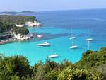
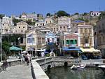
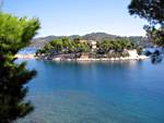
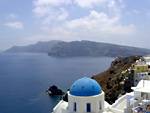
وب سایت ناوبری دریایی و دریانوردی در یونان و ترکیه
وب سایت آزاد و شخصی ارائه اطلاعات منحصر به فرد در ناوبری دریایی و دریانوردی در یونان و ترکیه ...
You have reached SailingIssues.com, a free and personal website providing unique information on marine navigation and sailing holidays in Greece and Turkey. This website continuously grows and has already become one of the leading Internet resources on Greek and Turkish yacht charter holidays, ahead of the typical commercial travel sites.
Free advice on yacht charter companies
Many visitors have shared their charter experiences with me.
Moreover, I myself have made the mistake of sailing with inferior companies before finding the more trustworthy charter companies.
So, if you would like independent advice on reliable yacht charters or sailing schools, you are welcome.
 |
|
|
|
Argolic - Saronic Athens |
Ionian Islands |
Dodecanese Eastern Sporades |
 |
|

|
|
Northern Sporades |
Cyclades |
Turkey: Lycian, Carian, Ionian |
برچسبها: معرفی وب سایت, ناوبری دریایی و دریانوردی, یونان و ترکیه, www
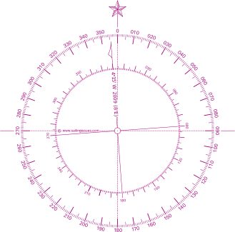
Compass navigation
Home Nav. course Sailing Greece Turkish Coasts Yacht charter Gulets ![]()
![]()
![]()
![]()
![]()
Marine compass
In China compasses have been in use since the Han dynasty (2nd century BCE to 2nd century CE) when they were referred to as “south-pointers”. However at first these magnets were only used for geomancy much like in the art of Feng Shui.
Eventually, during the Sung dynasty (1000 CE) many trading ships were then able to sail as far as Saudi Arabia using compasses for marine navigation. Between 1405 and 1433, Emperor Chu Ti's Treasure Fleet of the Dragon Throne ruled the entire South Pacific and the Indian Ocean, a territory that ranges from Korea and Japan to the Eastern coast of Africa.
در ادامه مطلب
بازگشت به صفحه اصلی وبلاگ مهندسی عمران راه و ساختمان(مهندس حسن فراهانی)
برچسبها: قصب نماهای ناوبری, Compass navigation, نقشه های دریایی, مهندس حسن فراهانی
ادامه مطلب...
منبع : حمل و نقل دریایی
کار عملی با نقشه های دریایی
Plotting and piloting
Home Nav. course Sailing Greece Turkish Coasts Yacht charter Gulets
Lines of position
The modern chart shows us positions of many recognizable aids to navigation
like churches and lighthouses, which facilitate the approach to a
coastal area. This concept originated from a chart by Waghenaer![]() and proved a milestone in the development of European cartography. This work was called “Spieghel der Zeevaerdt”
and proved a milestone in the development of European cartography. This work was called “Spieghel der Zeevaerdt”![]() and included coastal profiles and tidal information much like the
modern chart. It enables us to find the angle between the North and for
example an offshore platform, as seen from our position.
and included coastal profiles and tidal information much like the
modern chart. It enables us to find the angle between the North and for
example an offshore platform, as seen from our position.
 Compass courses |
 True courses |
Ranges
A precise way to obtain a LOP, and without a compass, is to locate two aids to navigation in line.
در ادامه مطلب
بازگشت به صفحه اصلی وبلاگ مهندسی عمران راه و ساختمان(مهندس حسن فراهانی)
برچسبها: کار عملی با نقشه های دریایی, مهندس حسن فراهانی
ادامه مطلب...
نقل قول :
اعلاميه هاي دريايي : اطلاعيه اي است كه در رابطه با موارد مرتبط با ايمني دريانوردي در محدوده آبهاي تحت حاكميت يك كشور توسط مرجع دريايي آن كشور صادر و فرمت آن بر اساس استاندارد هاي بينالمللي ذيل مي باشد:
-
دستورالعمل اطلاعات ايمني دريانوردي (MSI) صادره از سوي IALA
-
سند راهنماي خدمات جهاني اخطارهاي دريانوردي صادره از سوي IALA
-
كتابچه (IHO INT1) ، در مورد علائم و اختصارات در روي نقشه ها
-
ساير اسناد بين المللي صادر شده از سوي IHO و كميته فرعي CPRNW .
Noice to Mariners issued by PMO - 2011 |
|
|
| Noice to Mariners issued by PMO | |||||
|
2005 |
2006 |
2007 |
2008 |
2009 |
2010 |
|
|
|
|
|
|
|


بازگشت به صفحه اصلی وبلاگ مهندسی عمران راه و ساختمان(مهندس حسن فراهانی)
برچسبها: نمونه اعلاميه هاي دريايي, مهندس حسن فراهانی
منبع : سازمان بنادر و دریانوردی
آمار و اطلاعات
- کارگاههای ساخت و تعمیر شناورهای چوبی
- شناورهای ثبت شده مرکز و بنادر تابعه
- دفترخانه های مجاز به ثبت نقل و انتقال شناورها
- کارگاههای مجاز ساخت شناور از نوع فایبرگلاس
- شرکتهای مجاز به صدور گواهی نامه (SBM)
- کارگزاران رادیویی AAIC
- شرکتهای دارای گواهی نامه سند انطباق DOC
- موسسات رده بندی مورد تایید
- شرکتها و کارگاههای ساخت شناور فلزی
سیستم شناسایی و ردیابی کشتیها با برد بلند LONG RANGE IDENTIFICATION & TRACKING
LRIT
 |
ادامه مطلب...
کنوانسیون ملل متحد در مورد حقوق دریا
The United Nations Convention on
the Law of the Sea and the Delineation
of the Outer Limits of the Continental Shelf
Harald Brekke CLCS Member
به حجم 1.7 مگابايت
در فرمت پاورپوينت
ایستگاه های ساحلی ارتباطات دریایی
چرا ایستگاه ساحلی ؟
بر اساس ماده 5 قسمت B از کنوانسیون ایمنی جان اشخاص در دریا (SOLAS) هر کشور عضو کنوانسیون یا به تنهایی و یا با کمک دیگر کشورها می بایست تاسیسات ساحلی جهت فراهم نمودن خدمات هوایی یا زمینی ارتباطات رادیویی ایجاد نماید.سازمان بنادر و دریانوردی نیز یا توجه به این مهم و همچنین بر اساس بند 6 از ماده سوم آئین نامه سازمان که اداره شبکه های مخابراتی در دریا و خشکی برای تماس با کشتیها و بنادر تابعه را از وظایف سازمان قرارداده است اقدام به ایجاد ایستگاه های ساحلی ارتباطات دریایی و کنترل ترافیک نموده و با توسعه مدیریت بر این مراکز در راستای ارتقای ایمنی دریانوردی و انجام وظایف حاکمیتی خویش با مسئولیت اداره ارتباطات دریایی - اداره کل امور دریایی قدم برداشته است....
ادامه مطلب...
حقوق دریاها
( United Nations Convention on the Law of the Sea)
یک معاهده بینالمللی است که در ۱۰ دسامبر ۱۹۸۲ در سومین کنفرانس سازمان ملل متحد در مورد حقوق دریاها در جامائیکا به امضا رسید.
این قرارداد بینالمللی منبع اصلی حقوق دریاها است و به «قانون اساسی دریاها» معروف است و قواعد آن به طور گستردهای
حقوق بینالملل عرفی در مورد حقوق دریاها را بیان میکنند.این معاهده یکسال پس از پیوستن گویان به این کنوانسیون به
عنوان شصتمین کشور در ۱۶ نوامبر ۱۹۹۴ لازم الاجرا شد. در حال حاضر (فوریه ۲۰۰۹) ۱۵۷ کشور از جمله تمام اعضای شورای اروپا
به آن پیوستهاند و ۲۲ کشور نیز آن را امضا کرده اما هنوز به تصویب مجالس خود نرساندهاند.
این کنوانسیون محصول نه سال مذاکره توانفرسای کشورهای عضو ملل متحد بود و جایگزین چهار کنوانسیون سال ۱۹۵۸ ژنو شد که حدود سه-چهارم کشورهای جهان به عضویت آن درنیامده بودند. این کنوانسیونها به ویژه از آن رو ناکافی قلمداد میشدند که با پیشرفت فناوری امکان بهرهبرداری از فلات قاره و بستر اقیانوس فراهم شده بود
این کنوانسیون مناطقی همچون دریای سرزمینی، منطقه مجاور دریای سرزمینی، منطقه انحصاری اقتصادی و فلات قاره را تعریف کرده و مقررات حاکم بر آن از جمله حقوق و تکالیف دولتها در آنها را بیان میکند. تعریف تنگههای بینالمللی و صلاحیت دولتهای ساحلی در تنگههای بینالمللی و به رسمیت شناختن اصل آزادی دریاها از دیگر مقررات این کنوانسیون است. برخی مقررات این کنوانسیون صرفا بیان مجدد مواد کنوانسیونهای ژنو هستند و در واقع قواعد تثبیت شده حقوق بینالملل عرفی را به تصویر میکشند. برخی دیگر به ویژه مواد مربوط به منطقه انحصاری اقتصادی بازتاب رویه دولتهاست که قبل از تکمیل کنوانسیون به حقوق بینالملل عرفی تبدیل شده بود و برخی دیگر عدول از حقوق تثبیت شده گذشته کشورهاست که حاکی از روند رو به پیشرفت حقوق بینالملل است.
Related Power Point Files
United Nations Convention on the Law of the Sea and the DElination of the Outer Limits of the Continental Shelf by Harlod Brekke

Law of the Sea - Resources, Transport, Enviroment, Baselines, ...
Law of the Sea, General Information
Law of the Sea, Marine Scientefic Research
Report Difficulties to shokoohi@pmo.ir
[سازمان بنادر و دریانوردی - ۱ دی ۱۳۸۸ ]
به حجم 1.97 مگابايت
در فرمت پي دي اف
[سازمان بنادر و دریانوردی - ۲۸ مهر ۱۳۸۷ ]
به حجم 196 كيلوبايت
در فرمت پي دي اف
دستور العمل تایید فعالیت مراکز ساحلی
تعمیر و نگهداری تجهیزات رادیویی و کمک ناوبری شناورها
[سازمان بنادر و دریانوردی - ۸ بهمن ۱۳۸۶ ]
به حجم 196 كيلوبايت
در فرمت پي دي اف
